Last verified: 18 November 2026. The Class 9 pattern (180 minutes, 150 questions, 400 marks; Social Science 25 questions, 50 marks; English only; no negative marking) and the qualifying rule (25% per section, 40% aggregate) are ✅ CONFIRMED from the NTA AISSEE 2027 Information Bulletin (3 November 2026). The syllabus topics named here — resources, land, agriculture, industries, human resources for geography; colonial rule, 1857, the freedom movement for history; Constitution, parliament and judiciary for civics — follow the bulletin’s Class 8 NCERT-level syllabus. The study method in this article is editorial guidance, not an official instruction.
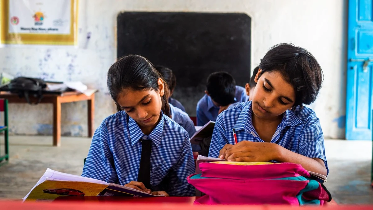
 Photo: Pexels
Ask a parent what worries them about AISSEE Class 9 and you will hear the same two answers: Maths, because it carries 200 of the 400 marks, and English, because the whole paper is in English only. Almost nobody says Social Science. And that is exactly why it quietly decides results.
Here is the arithmetic. Social Science is 25 questions for 50 marks — the same weight as Intelligence, English and General Science. The qualifying rule needs 25% in each section, so a child needs at least 12.5 marks out of 50 here, roughly 7 correct answers out of 25, just to stay in the race. A child who scores brilliantly in Maths and blanks on Social Science does not get a low rank. They get disqualified. Our worked examples of the 25% qualifying rule show how often that happens — and how cheap the insurance is.
The good news: Social Science is the most improvable section in the paper, and the geography half of it is the most improvable part of the section. Because geography, unlike history dates, can be seen. A child who can picture the India map can answer questions they never formally revised. This article is about building that picture.
The Class 9 paper is set at Class 8 NCERT level. The geography syllabus covers resources, land, agriculture, industries and human resources. Translated into map work, that means five layers, learned in this order:
| Layer | What to mark on the map | Why it matters |
|---|---|---|
| 1. States and capitals | All states and union territories, with capitals | The base layer — every other layer hangs on it |
| 2. Physical features | Himalayas, Western and Eastern Ghats, Deccan Plateau, Thar Desert, major rivers (Ganga, Yamuna, Brahmaputra, Narmada, Tapti, Godavari, Krishna, Kaveri) | Rivers and mountains are the landmarks questions are built around |
| 3. Resources | Coal belts (Jharkhand, Chhattisgarh, Odisha), iron ore (Odisha, Karnataka, Chhattisgarh), bauxite, manganese, petroleum (Assam, Gujarat, Mumbai High) | The resources chapter is the most map-heavy part of the syllabus |
| 4. Agriculture | Wheat belt (Punjab, Haryana, western UP), rice belt (West Bengal, Tamil Nadu, coastal Andhra), cotton (Maharashtra, Gujarat), tea (Assam, Darjeeling), coffee (Karnataka) | Crop-region questions reward children who know where food grows |
| 5. Industries | Steel plants (Jamshedpur, Bhilai, Rourkela, Bokaro, Durgapur), textile centres (Mumbai, Ahmedabad), IT hubs (Bengaluru, Hyderabad) | Industry questions are almost always location questions |
Learn them in that order. A child who tries to memorise steel plants before they know where Chhattisgarh is will forget both. The map is a stack, and the bottom layer has to be solid first.
Honestly, most map “preparation” fails the same way: a child stares at a finished atlas map for twenty minutes, feels like they know it, and cannot reproduce a single state boundary the next morning. Looking is not learning. Marking is learning.
Here is the drill. It takes fifteen minutes, and it needs only a blank outline map of India, a pencil, and the NCERT Class 8 geography book open beside it.
Minutes 1–5: the blank-map test. Take a blank outline map. Mark today’s five targets from memory — say, the four southern states and their capitals, or the five peninsular rivers. No peeking. Then check against the book, and correct in a different colour. The red marks are the lesson.
Minutes 6–10: one chapter, one map. Read one short section — today, the coal and iron-ore belts — and mark exactly what the chapter names. Not everything in the chapter. Just the places. Then close the book and say each place out loud with the state it sits in: “Jharia coalfield — Jharkhand. Bailadila iron ore — Chhattisgarh.” Saying it aloud matters; it forces the brain to retrieve instead of recognise.
Minutes 11–15: five questions, backwards. Instead of asking “where is X?”, ask it the other way: “which mineral is mined in Odisha?”, “which river flows through the Narmada valley?”, “which state grows the most tea?” Five questions, written down, answered from memory, checked immediately. Wrong answers go into the same error log you keep for mock tests — our guide to analysing mock tests properly explains the method, and it works just as well for map drills as for full papers.
Do this five days a week. One layer per week, then rotate. By the fourth week, the map stops being a picture your child looks at and becomes a picture they carry.
Mistake one: learning states alphabetically. Andhra Pradesh, Arunachal Pradesh, Assam — the alphabet has nothing to do with geography. Learn states in regional groups instead: the north, the west, the south, the east, the north-east. The map itself becomes the memory aid, and a question about a neighbour state triggers the whole region.
Mistake two: memorising names without the “why”. A child who knows that cotton grows in Maharashtra but not why — black soil, the Deccan trap — will forget it under exam pressure. One line of reason per fact is enough: “cotton needs black soil; black soil is the Deccan; so cotton is Maharashtra and Gujarat.” Reason is glue.
Mistake three: leaving map work for the last month. Visual memory fades faster than any other kind. A map learned in December and never revisited is gone by 31 January. Fifteen minutes a day from now beats two hours a day in the final week — and the final week should be revision, not first learning. The same principle runs through our Class 9 Science section strategy: steady, small, and finished early.
The exam is on 31 January 2027. From tonight, 18 November, that is about ten weeks. Six of them are for map work; the rest are for full-paper revision. Here is the shape:
| Weeks | Focus | Daily drill |
|---|---|---|
| 1–2 | States, capitals, neighbours | Blank-map test, five states a day, regional groups |
| 3 | Physical features — mountains, rivers, plateaus | Mark the river systems; trace each river from source to sea |
| 4 | Resources — coal, iron ore, bauxite, petroleum | One mineral belt a day, with the state and the use |
| 5 | Agriculture — crop regions | Wheat, rice, cotton, tea, coffee; one crop, one map |
| 6 | Industries — steel, textiles, IT | Steel plants first, then the rest; link each plant to its raw material |
| 7–10 | Mixed revision + mock papers | Two blank-map tests a week; map questions inside every mock paper |
One last thing, and it is the most human part of this. Map work is the one section where a parent can genuinely help without knowing the subject. Sit with your child for fifteen minutes, hold the answer key, and ask the five questions. You do not need to know where Bailadila is. You need to be the person who asks, checks, and notices when Tuesday’s mistakes are still there on Friday. That is the whole job — and it is worth 50 marks.
How many marks is Social Science in AISSEE Class 9?
25 questions for 50 marks — one-eighth of the 400-mark paper. It is the same weight as Intelligence, English and General Science, and a weak section can disqualify an otherwise good score because of the 25 percent sectional qualifying rule.
Is map work part of the AISSEE Class 9 Social Science syllabus?
Yes, inside the geography portion. The Class 9 paper is set at Class 8 NCERT level, and the geography syllabus covers resources, land, agriculture, industries and human resources — all topics that are tested through locations on the India map.
Which map should my child practise with for AISSEE?
A plain outline map of India — political and physical — plus the maps inside the NCERT Class 8 geography textbook. Practise marking states, rivers, mountain ranges, mineral belts, crop regions and industrial centres by hand, from memory, not by staring at a finished map.
How much time should map work take each day?
About 15 minutes a day, five days a week, is enough if it is regular. One short marking drill plus five revision questions beats a two-hour session once a month, because map memory is visual memory and it fades fast without repetition.
Should my child memorise state capitals for AISSEE?
Yes — states with their capitals are the base layer of map work, and they come up in both geography and general-knowledge style questions. Learn them in regional groups (north, west, south, east, north-east) rather than alphabetically, so the map itself becomes the memory aid.
What is the qualifying rule for AISSEE Class 9 Social Science?
At least 25 percent in each section and 40 percent in aggregate, as per the AISSEE 2027 Information Bulletin. For Social Science that means at least 12.5 marks out of 50 — so roughly 7 correct answers out of 25, with no negative marking, is the floor to clear.
How helpful was this article?